Poker Flat
Near La Porte, CA. Start at County Rd. 512 and carefully follow your dirtections to La Porte, St. Louis Bridge, Howland Flat & Poker Flat. 4-wheel drive only.
Poker Flat had its beginnings in the early 1850’s. It is reported that only 12 families were living in the camp by 1856, but 400 miners lived within two miles. Henry Cohn, who had a store there from 1857 to 1863, described Poker Flat as a “miserable hole.”
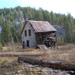
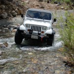
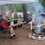
Today Poker Flat is a beautiful setting on Canyon Creek with artifacts from the 1800’s still visable. Goldmining claims are still active. Though not too far from La Porte, it is strictly a 4-wheel drive trip. But, when you get there you can camp at six campsites constructed by the U.S. Forest Service complete with picnic tables and fire pits. The toilet facilities are basic.
It’s an easy and picturesque drive from Oroville to La Porte via the Forbestown Road. Leave Oroville on Hwy. 162, also Oroville-Quincy Road. About six miles east of town, Forbestown Road goes off to the right and it’s about 14 miles to Forbestown. At Forbestown the name of the road changes to Challenge cut Off Road and leads to La Porte Rd. At that intersection, you will take a hard left and go through Challenge, CA. Stay on the La Porte Road which eventually changes to the Quincy La Porte Road and tang you onto La Porte.
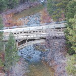
Here you can stop for provisions if necessary and just north of town is a warming station and public restrooms. A short 1/4 mile further on the right is St. Louis Rd. Take it east bearing right and leading to the St. Louis Bridge. Immediately after the bridge turn right. A mile or so along, the Port Wine Ridge Road will intersect from the right and the name of the road changes to Port Wine Ridge Rd. Contine on to Howland Flat an abandon old mining town where you can still the the ruins of the Wells Fargo Office. Here the name of the road changes to Poker Flat Road and will lead you to Poker Flat.
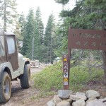
You’ll see the 4-wheel drive sign at the top of the ridge leading down to the former mining village at Poker Flat on Canyon Creek. Best to plan on camping overnight.
Then you can cross the creek and continue up the mountain on Saddleback Road bearing left onto Eureka Mine Rd. and to hwy. 25 and on to hwy. 49.


